Known locally as Jèrri
The largest and most southerly Channel Island, whose reefs and beaches are transformed twice a day by an exceptionally large tidal range.
5-minute guide
Today, Thursday 8 October
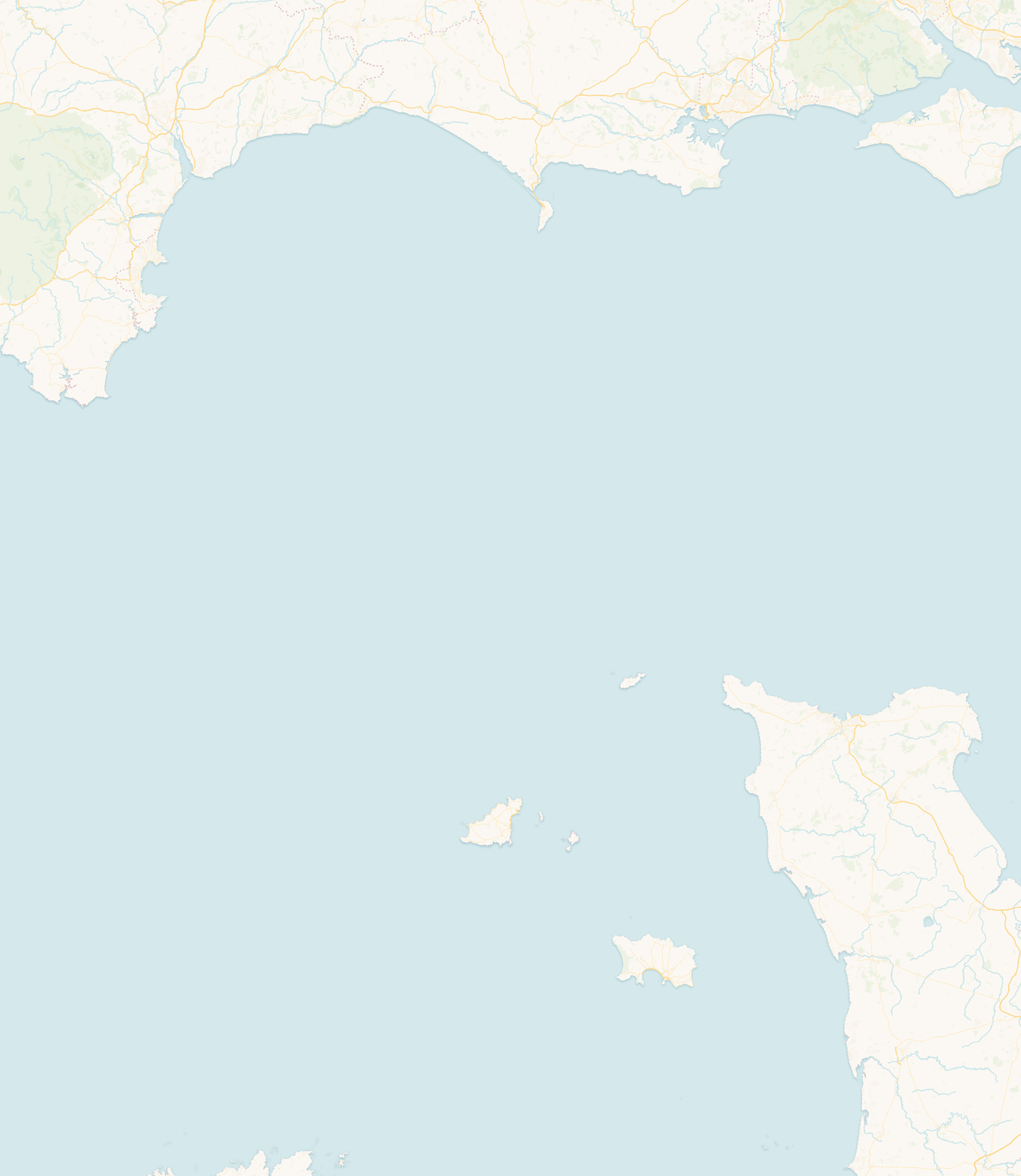
Jersey is the largest and most southerly of the Channel Islands, lying in the Bay of St Malo about 14 miles from the Normandy coast and roughly 85 miles south of England. Like Guernsey it is a British Crown Dependency, self-governing and not part of the United Kingdom, with its own parliament, the States of Jersey, and twelve parishes centred on the town of St Helier.
More than any other main Channel Island, Jersey is reshaped by the sea. At high water the tide reaches seawalls, harbour walls and the foot of the cliffs. At low water it draws back to reveal broad beaches, gullies, rock platforms and reefs, especially along the south and east coasts.
You will sometimes read that the island “doubles in size” at low tide. It is more accurate to say that the area of exposed shore and intertidal reef increases dramatically; the island’s own land area does not change. That expanse of shore is wonderful to explore and genuinely hazardous: the tide returns quickly across flat ground, so route-specific guidance matters far more than a single “low tide” time.
Jersey sits within one of the most energetic tidal systems in Europe. Atlantic tidal energy is funnelled into the narrowing, relatively shallow waters around the Cotentin peninsula and the Bay of St Malo, and the shape and depth of that basin amplify the vertical rise and fall of the sea. The result is one of the largest tidal ranges in the world, over 10 metres on the biggest spring tides.
As with any coast, it is worth separating tidal height from tidal current: the two peak at different times, and fast-flowing water around reefs and causeways can be dangerous even when the height looks unremarkable.
The west is dominated by St Ouen’s Bay, a long, open, Atlantic-facing beach known for surf, dunes and sunsets. The north is a coast of high cliffs and wooded valleys at Plémont, Grève de Lecq and Bouley Bay. The south and east (St Aubin’s Bay, St Helier, Gorey and the Royal Bay of Grouville) front vast intertidal flats and reefs. The south-west gathers St Brelade’s Bay, Ouaisné, Beauport and Portelet.
Two of Jersey’s landmarks stand on tidal rocks reached by causeway, and both catch people out every year. A general St Helier tide time is not enough on its own: use the official access guidance for each crossing, watch the water rather than the clock, and if in any doubt stay on the shore.
Elizabeth Castle stands on a tidal islet in St Aubin’s Bay, cut off by the sea twice a day. At lower states of the tide it can be reached on foot along the causeway from St Helier; as the water rises the causeway covers and access changes to the amphibious Castle Ferry, which runs when the castle is open. Jersey Heritage publishes a walking-times guide, and Jersey Coastguard warns that the causeway covers very quickly on an incoming tide. Check the current castle information and the causeway calculator before you set out.
Official guidance: Jersey Heritage: Elizabeth Castle · Jersey Coastguard: causeway guidance · Causeway access calculator
La Corbière lighthouse stands on a tidal rock off Jersey’s south-west corner, connected to the shore by a causeway at lower water. The incoming tide covers the causeway extremely quickly. The lighthouse is around 300 metres from the shore, so allow time for the walk back. Jersey Coastguard operates a warning siren: when it sounds, the causeway is about to cover, and you should walk back to the slipway straight away rather than wait. Check the tide and conditions before crossing.
Official guidance: Jersey Coastguard: La Corbière causeway · Causeway access calculator
Beyond Jersey’s main coastline lie extensive reef systems where a small amount of land stays above water while a far larger world of rock, sandbank, channel and shallow sea is uncovered by the falling tide. Les Écréhous, Les Minquiers, Les Dirouilles and Les Pierres de Lecq are not simply small islands but parts of broad marine landscapes shaped by an exceptional tidal range.
Les Écréhous lie to the north-east of Jersey, between the island and the Normandy coast. At higher water the huts and rocks can look marooned in the sea; as the tide falls, reefs, sandbanks and channels emerge across a much wider area. Its Maîtresse Île carries a small cluster of huts. Together with Les Dirouilles, Les Écréhous form one of Jersey’s Ramsar wetlands of international importance, and grey seals are among the wildlife recorded here. Visitors normally reach the reef by boat or guided excursion, as the channels and tidal streams need experienced navigation.
Les Minquiers lie about 20 kilometres south of Jersey and form an even larger reef, uncovered dramatically at low water. This reef has its own Maîtresse Île with a small group of huts, but the permanently dry land is only a fraction of the surrounding rock. Les Minquiers are a separate Ramsar wetland of international importance, reached by sea rather than on foot, and best visited with an experienced skipper who understands the channels, weather and tide.
Jersey has four Ramsar sites in all: the South East Coast of the island, Les Écréhous and Les Dirouilles together, Les Minquiers, and Les Pierres de Lecq (the Paternosters) to the north. Their intertidal habitats mix rock, sand, gravel, shallow channel and kelp, and support marine life and seabirds. Low tide can make the reefs look open and inviting, but water keeps moving through the channels, and small errors of timing, navigation or weather can have serious consequences. Follow current Ramsar guidance and respect seasonal wildlife-protection areas.
Official guidance: Government of Jersey: Ramsar sites
Jersey’s human story is a long one, from Palaeolithic occupation at La Cotte de St Brelade and Neolithic tombs such as La Hougue Bie, through Norman rule and the division from continental Normandy in 1204, to castles like Mont Orgueil, the Newfoundland cod trade, privateering and the German Occupation of 1940–1945. Liberation is marked each 9 May.
English is the main language, alongside the traditional Norman language Jèrriais and, reflecting the island’s modern communities, Portuguese and Polish. Jersey is known for its cattle and its Royal potatoes, for black butter and ormers, and for events such as the Battle of Flowers and Liberation Day.
No. Jersey is a self-governing British Crown Dependency with its own parliament and laws. It is not part of the United Kingdom.
France. Jersey lies in the Bay of St Malo, about 14 miles from the Normandy coast and around 85 miles from England.
The shape and depth of the Bay of St Malo funnel and amplify the Atlantic tide, giving Jersey one of the largest tidal ranges in the world, over 10 metres on the biggest spring tides.
Not literally. The land area stays the same, but so much beach, reef and rock is exposed at low water that the area you can walk on grows dramatically.
Yes, across a tidal causeway from St Helier when the tide is low enough. Check the crossing times and allow a safe margin to return, as the causeway floods on the rising tide.
No. The US state of New Jersey was named after the Channel Island, but they are entirely separate places.
English is the main language. The island’s traditional Norman language is Jèrriais, and Portuguese and Polish are also spoken by local communities.
Only for part of the tidal cycle, and the causeway covers extremely quickly on the incoming tide. Jersey Coastguard runs a warning siren: when it sounds, walk back to the slipway straight away. Use the official causeway access calculator and check conditions rather than judging it from the day’s high and low water.
No. They are offshore reefs reached by boat or guided excursion, not on foot from Jersey. The tidal streams and channels need experienced navigation, and both are protected Ramsar wetlands.
This guide draws on information from official island authorities, local heritage and environmental organisations, and recognised coastal and hydrographic sources.
Last reviewed: July 2026. Geographic, historical and coastal information has been checked against official and authoritative local sources. Tide predictions remain forecasts, and local conditions can vary.
Check today’s high and low waters before heading to the shore, or open the full Jersey tide table.
 Jersey