Detailed guides to Jersey, Guernsey, Herm, Alderney and Sark, and how geography and tides shape each island’s coast.
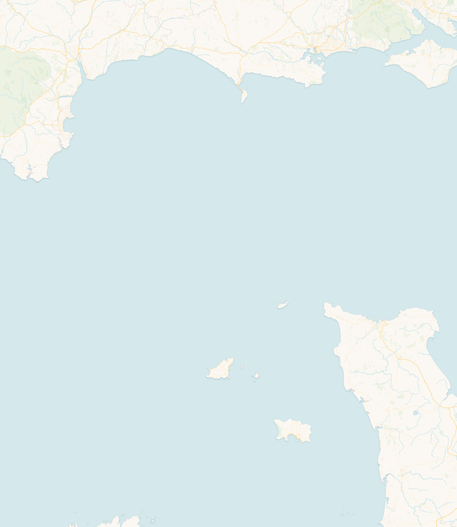
The Channel Islands lie in the English Channel, close to the coast of Normandy and much nearer to France than to mainland Britain. They are divided between two self-governing Crown Dependencies: the Bailiwick of Guernsey and the Bailiwick of Jersey. Neither is part of the United Kingdom.
The Bailiwick of Jersey consists of Jersey and its surrounding reefs and islets. The Bailiwick of Guernsey takes in Guernsey, Alderney, Sark, Herm and several smaller islands; Alderney and Sark each have their own elected legislature, while Herm is administered as part of Guernsey.
The islands share a Norman-French heritage, but each has its own landscape, community and relationship with the sea. Their large tidal range uncovers wide beaches, reefs, causeways and rock pools at low water, then covers them again as the tide returns. Knowing the state of the tide is part of using the coast here safely.
Each guide explores the island’s geography, coastline, tidal character, history and key places.
The largest and most southerly Channel Island, with broad sandy bays, rocky northern cliffs and extensive reefs exposed by an exceptional tidal range.
Read guide →Broad sandy bays along much of the west coast, lower rocky shores in the north and high cliffs in the south, with St Peter Port and the main harbour on the east coast.
Read guide →A small, car-free island of white-sand beaches, coastal paths and wildlife-rich reefs, a short boat trip east of Guernsey from St Peter Port.
Read guide →The northernmost inhabited Channel Island, with sandy bays, rocky headlands, historic forts and powerful tidal streams in the Race and the Swinge.
Read guide →A high, car-free island edged by cliffs and small rocky coves, where steep paths lead down to beaches, caves and natural pools whose access changes with the tide.
Read guide →| Island | Coastline | Tide reference | What the tide changes |
|---|---|---|---|
| Jersey | Broad sandy bays, rocky northern cliffs and extensive eastern reefs | St Helier | A large tidal range exposes vast areas of beach and reef, and tidal routes to Elizabeth Castle and La Corbière |
| Guernsey | Broad west-coast beaches, rocky northern shores and high southern cliffs | St Peter Port | Reefs and rock pools emerge around the coast, and the Lihou causeway opens during its published crossing windows |
| Herm | Long sandy beaches in the north and east, with a rockier southern and western coast | St Peter Port | Beaches broaden and rocks and pools emerge, and passenger boats may switch landing place as the water level changes |
| Alderney | Sandy bays, rocky headlands and highly exposed surrounding waters | Braye Harbour | Powerful tidal streams run through the Alderney Race to the east and the Swinge to the west |
| Sark | A high, cliff-bound island with small bays reached by steep paths | Maseline Pier | Low water reveals caves, natural pools and beach that the rising tide covers again |
About the tide references: these are the locations used for the tide predictions on this site. Tide times and heights vary around each island, and tidal streams are different from tide height: they can keep running strongly around the time of high or low water.
The Channel Islands lie in the shallow waters of the English Channel and the Gulf of St Malo. As the Atlantic tide moves into this narrowing, shallowing sea it is amplified, and the shape and depth of the seabed and coastline add a strong resonant effect. The result is one of the largest tidal ranges in Europe, and a huge area of beach, reef and rock uncovered at low water and then covered again as the tide returns.
It helps to separate two things. Tidal range is the vertical difference between high water and low water, and it is largest around Jersey and the Gulf of St Malo. Tidal currents are the horizontal movement of the water as the tide floods and ebbs; they run fastest where the sea is forced past headlands and through narrow channels, such as the Alderney Race and the Swinge. A large range in one place does not always mean the fastest current in the same place, and high or low water at a tide station need not line up with slack water offshore.
The two bailiwicks take in far more than the islands with full guides. A few of the others you may come across:
The Channel Islands are close together on a map, but travelling between them depends on the season, the weather and the available air or sea services.
Guernsey and Jersey are the main transport hubs. Alderney can be reached by air and, at certain times of year, by sea. Sark has no airport and is reached by boat, principally from Guernsey. Services to the smaller islands and offshore reefs are more limited and depend heavily on suitable weather and sea conditions.
Routes and operators change, so check the current official travel information before planning a multi-island trip. Allow flexibility where a journey involves a small vessel, as strong winds, swell or poor visibility can disrupt services even when the tide itself is suitable.
Official travel information: VisitGuernsey: inter-island travel · Visit Jersey: getting to Jersey · Visit Alderney: travel · Isle of Sark: travel
 Jersey