A small, car-free island just east of Guernsey, where pale sandy beaches and clear water in the north and east give way to a rockier southern coast, and low tide reveals a much broader shoreline.
7-minute guide
Today, Thursday 8 October
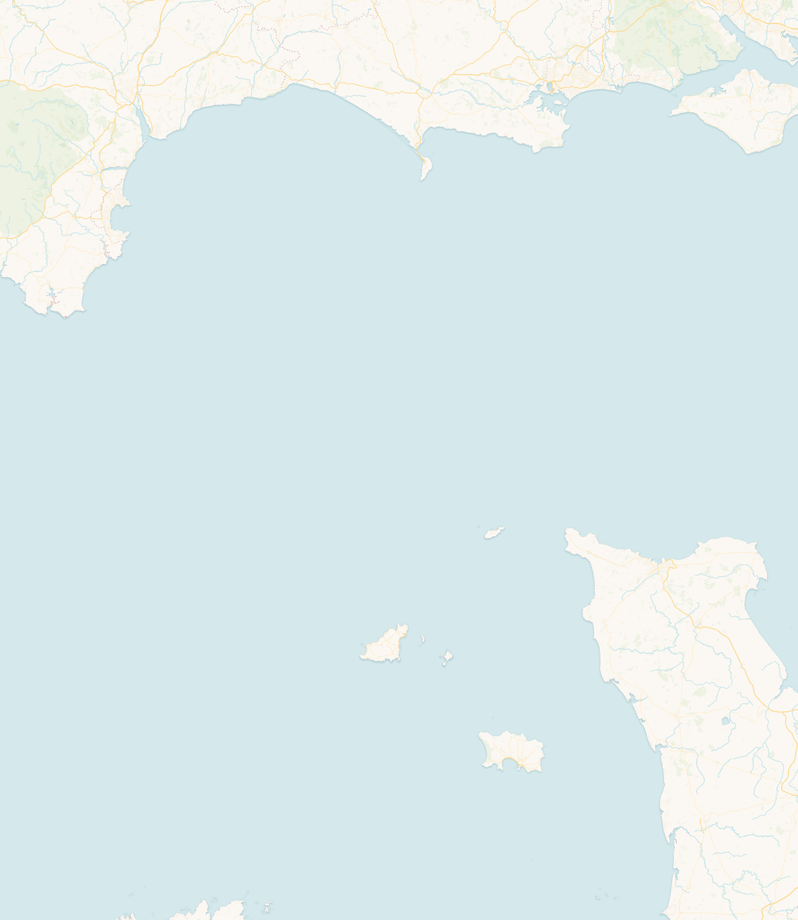
Herm is a small island in the Bailiwick of Guernsey, lying about 3 miles east of Guernsey and just north of the private island of Jethou. It is administered as part of Guernsey rather than having its own legislature, and it is car-free: there is no public motor traffic, and visitors explore on foot.
Almost everyone arrives by passenger boat from St Peter Port, a crossing of around 20 minutes. Boats normally land at Herm Harbour on the west side; at lower states of tide they may use Rosaire Steps farther along the coast instead. Which landing is in use depends on the state of the tide that day.
For its size, Herm’s coast changes character sharply from one side to the other. The north and east are low and sandy, with pale beaches and low, open common land, and the clear water along the north and east draws swimmers and walkers. Shell Beach stretches along much of the east coast, with the smaller cove of Belvoir Bay tucked below it.
The south and west are rockier, with low cliffs, the harbour and wide views back to Guernsey and across to Jethou. At low water the sea draws back to expose rocks, pools and additional stretches of sand around the island and the smaller islets nearby, opening up much more shore than there is at high tide.
Herm’s beaches are one of the main reasons people visit, and each changes with the tide, the wind and the swell.
A long, pale beach on the east coast, named for the countless tiny shell fragments mixed through its pale sand. It runs for roughly three-quarters of a mile towards the island’s northern point. It is popular for swimming in suitable conditions, but the water can be cold and currents and sea conditions vary, so judge the beach on the day rather than by the time of low water alone.
A smaller, more enclosed cove below Shell Beach on the east coast. Its sheltered setting makes it a popular place to sit or swim when conditions suit.
On the west side, Fisherman’s Beach lies beside the harbour, and Rosaire Steps a little to the south serves as the boat landing when the tide is too low for the harbour. This is the working, Guernsey-facing side of the island rather than a stretch of open sand.
The live times on this page come from St Peter Port, the nearest prediction station included in our licensed data. They give a useful indication of the tidal cycle around Herm, but they are St Peter Port predictions rather than a separate forecast for Herm Harbour. St Peter Port is only a few miles away, but local water levels and conditions at Herm can still differ from the prediction shown, so do not use these times alone for navigation.
The rise and fall here is large: the tidal range in this part of the Channel Islands can approach ten metres between high and low water on the biggest tides. As the sea falls, Herm’s beaches broaden and rocks, pools and further stretches of sand emerge around Herm, Jethou and the smaller islets. The rising tide covers them again, and can affect whether passenger boats use Herm Harbour or Rosaire Steps.
A path runs right around the coast, and walking the circuit is the classic way to see the island. Most people manage it in a couple of hours, plus time on the beaches. The going is a mix of sandy and grassy paths, with some steps, uneven ground and exposed common in the north, so sensible footwear helps.
Herm, its neighbour Jethou and the rocks and islets around them form part of a wetland of international importance. Designated in October 2015, the Ramsar site takes in the two islands, nine rocky islets including Grande Fauconnière, Crevichon and Brehon Tower, six sandbanks known as the Humps, and the surrounding shallow tidal waters. Its habitats include seagrass, maerl beds, reefs and important feeding and breeding areas for fish, seabirds and marine mammals.
Almost 100 bird species have been recorded on Herm. Puffins can sometimes be seen in the waters off the south-east coast during spring and early summer, while dark-bellied brent geese overwinter in the area after migrating from the Arctic. Curlews, oystercatchers and cormorants are among the other birds found around the island, and Atlantic grey seals use the wider reef system.
Yellow marker buoys off Puffin Bay identify waters where puffins may gather on the surface. The Channel Islands Ramsar code of conduct asks boat users to travel slowly near the coast, to keep their distance from wildlife, and not to land on the Humps between 1 January and 31 July; Brehon Tower should not be landed on at any time. Check the current code before visiting by boat or kayak.
Official guidance: Ramsar: Herm, Jethou and The Humps · Channel Islands Ramsar code of conduct · States of Guernsey: Herm puffin-awareness buoys
The open Common at the northern end of the island holds prehistoric chamber tombs and other archaeological remains, showing that people used Herm thousands of years ago. Finds from the island point to activity during both the Neolithic and Bronze Age, with much of the surviving prehistoric landscape concentrated at the northern end.
Near the centre of the island stands St Tugual’s Chapel, dedicated to St Tugual, a sixth-century Celtic saint. Tradition associates him or his followers with Herm, although the details of that early connection are uncertain. The chapel is first recorded in 1251, and much of the surviving structure is medieval, though it has been altered and restored over the centuries, including after the Wood family took on the island in 1949. It is still used today.
People have been on Herm since prehistory, leaving tombs on the Common. Herm was associated with religious communities during the medieval period, and St Tugual’s Chapel remains the clearest surviving link with that history. Between 1570 and 1737 the governors of Guernsey used Herm as a private hunting ground.
In the nineteenth century it became a granite-quarrying island, with around 400 quarrymen at its peak. Herm’s official history records that its granite was supplied for maintenance work on London Bridge and for the steps of St Paul’s Cathedral. German forces occupied Herm, like the rest of the bailiwick, from 1940 until the end of the occupation in May 1945. In 1949 Peter and Jenny Wood took on the lease and began repairing the buildings and developing the island for residents and visitors. Today Herm is leased from the States of Guernsey and run as a visitor island.
Yes. Herm is part of the Bailiwick of Guernsey and is administered as part of Guernsey itself. Unlike Alderney and Sark, it has no separate legislature of its own.
By passenger boat from St Peter Port in Guernsey, a crossing of around 20 minutes. Boats land at Herm Harbour, or at Rosaire Steps on the west coast when the tide is too low for the harbour, which dries out at low water.
No. There is no public motor traffic; visitors get around on foot, and the island’s staff use a few working vehicles.
Most people walk the coastal circuit in a couple of hours, plus time for the beaches.
Yes. The tidal range in this part of the Channel Islands can approach ten metres on the biggest tides, and low water broadens the beaches considerably.
The live times here come from St Peter Port, the nearest prediction station included in our licensed data. Published tidal information also exists for Herm Harbour, but the figures shown are St Peter Port predictions rather than a separate Herm forecast, and should not be used alone for navigation.
It is popular for swimming in suitable conditions, but the water can be cold and currents and sea conditions vary. Judge the beach on the day, and never rely on the time of low water alone.
For the countless tiny shell fragments mixed through its pale sand.
Puffins can sometimes be seen in the waters off the south-east coast during spring and early summer. Sightings are not guaranteed. Keep well back from birds on the water, and respect the marker buoys and the Ramsar code of conduct.
Yes. There is a hotel, self-catering cottages and a campsite. Check the official Herm website for current options and opening seasons.
This guide draws on information from official island authorities, local heritage and environmental organisations, and recognised coastal and hydrographic sources.
Last reviewed: July 2026. Geographic, historical and coastal information has been checked against official and authoritative local sources. Tide predictions remain forecasts, and local conditions can vary.
Check today’s high and low waters before heading to the shore, or open the full Herm tide table.
 Jersey