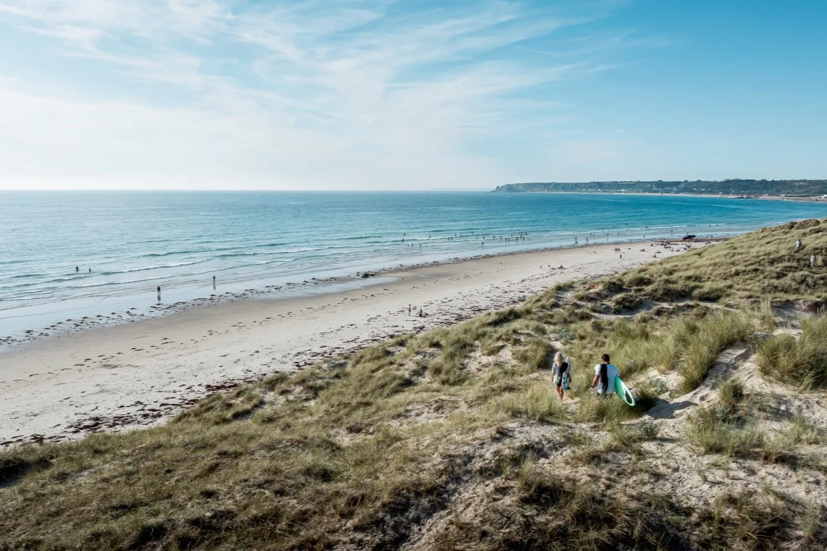
Jersey's long Atlantic beach, with miles of sand, strong surf and several distinct access points. The sea retreats a long way at low tide, while higher tides bring the waves close to the sea wall in places.
These predictions use St Helier, Jersey’s standard reference port. Local timing and conditions at St Ouen's Bay can vary slightly with weather and coastal geography. Times are shown in local Jersey time.
St Ouen's Bay runs along Jersey's exposed Atlantic coast and is the island's longest continuous beach. It is commonly described as around five miles, or 8km, long. Unlike Jersey's smaller coves, this is an open, energetic shoreline where wind, swell and tide can change the character of the beach quickly.
The beach is not one uniform place. Le Braye, Watersplash, El Tico and La Pulente are distinct sections with their own parking, access points and patterns of use. Le Braye is towards the southern end, Watersplash lies further north, and El Tico is in the northern half of the bay.
The broad sands and shallow gradient mean the shoreline can be a considerable distance from the sea wall around low water. As the tide rises, the water returns quickly across the flatter parts of the beach. Rocks exposed at lower tides interrupt the sand in the southern part of the bay and again towards the north.
At low water, the bay becomes an exceptionally wide expanse of firm and softer sand, with the sea far from the road and sea wall. The long walk to the water is most noticeable around the central and southern parts of the bay. Lower tides also expose rocky areas around Le Braye and towards the northern end.
Mid tide often gives the most recognisable beach experience: a substantial strip of sand remains, but the water is closer to the main access points. Because the beach shelves gradually, the incoming tide can cover a large horizontal distance.
Near high tide, the amount of sand depends on the height of the tide and the section of bay. On larger tides, waves can approach the sea wall and backwash can develop where surf meets the wall. The usable strip of beach may become narrow or disappear locally even though other parts of the bay still retain sand.
This is not a beach where a single best tide works for everyone. Walkers generally gain most space around low water. People carrying boards may prefer not to cross the full low-tide beach. Swimmers should judge the sea state and use a lifeguarded area when patrols are operating.
St Ouen's Bay is Jersey's principal surfing beach. Its Atlantic exposure, long fetch and gently shelving beach allow beach-break waves to form across several parts of the bay. Conditions range from smaller learner-friendly surf to powerful waves, strong currents and heavy shore break.
Swimming conditions can be demanding. Rip currents occur in the bay and can move or strengthen as sandbanks, waves and tides change. In April 2026, the RNLI reported rescuing surfers during heavy surf, strong rip currents, backwash against the sea wall and a rapidly incoming tide.
The presence of surfers does not mean the water is suitable for ordinary swimming. In surf, people should remain within the red-and-yellow flagged swimming area where lifeguards have marked one, and surfers should use the black-and-white flagged zone.
The beach is patrolled at Le Braye, El Tico and Watersplash, rather than along the entire bay. The published 2026 patrol hours are 10am to 6pm, but patrol dates and flagged zones should be checked on the day.
Lower tides reveal rocky areas at both ends of the bay and around some of the offshore reefs. These can contain pools and channels, but St Ouen’s is primarily an open surf beach rather than a sheltered rock-pooling bay.
The scale of the beach can make the incoming tide deceptive. A person exploring rocks may still appear to have a great deal of open sand behind them while channels and lower areas are already filling.
The bay is most exposed to winds and swell from the west and south-west. Onshore winds can make the surf rougher and increase wind-blown sand along the upper beach. Offshore winds may flatten the surface close to shore but can make inflatables and paddlecraft harder to return with.
Conditions vary along the beach because of reefs, sandbanks and headlands. The appearance of the water from the sea wall should not be treated as a complete assessment of the bay.
There are numerous roadside parking areas and slipways along the Five Mile Road. Some slipways are cobbled or uneven, and low tide can leave a very long journey across sand before reaching the water.
BeachAbility provides a balloon-wheel beach wheelchair from a storage point close to Le Braye. Visit Jersey lists accessible parking, accessible toilets and partial wheelchair access in this part of the bay.
Facilities vary by section but include:
The Government of Jersey monitors two parts of St Ouen's Bay separately, at Le Braye and Watersplash. Each result reflects the water only at the time and place it was sampled, not the whole shoreline or every day in between.
Water quality can deteriorate in streams and outfalls during and after heavy rainfall.
No community photos of St Ouen's Bay yet. Be the first to add one and help build a picture of the beach at every state of the tide.
Add your photoOther bays and beaches close to St Ouen's Bay.
 South-west
 South-west
 South-west
Tides. Tide predictions are forecasts. Actual sea level is affected by atmospheric pressure, wind and waves. Always observe the sea and your surroundings.
Swimming. Sea swimming carries risks: currents, waves, rocks, submerged structures, boats and cold water. This page is for planning and does not confirm conditions are safe. Do not assume the beach is lifeguarded.
Facilities. Facilities and café opening hours change seasonally. Check directly before making a journey specifically to use them.
 Jersey