A long, gently shelving east-coast beach where the sea retreats a considerable distance at low water. Higher water is better for swimming close to shore, while low tide reveals an extensive intertidal landscape.
These predictions use St Helier, Jersey’s standard reference port. Local timing and conditions at Royal Bay of Grouville can vary slightly with weather and coastal geography. Times are shown in local Jersey time.
Low tide reveals miles of sand and reef, but channels can fill behind you as the sea returns. Stay close to the ordinary shoreline unless you are with an experienced local guide.
The Royal Bay of Grouville occupies much of Jersey's east coast between Gorey and La Rocque. Locally known as Long Beach, it is one of the island's longest sandy shores.
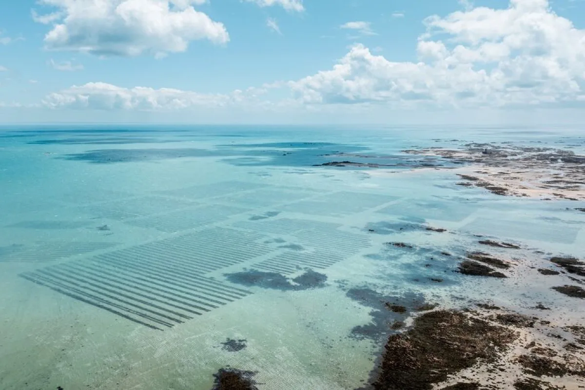
The bay shelves very gently. At high water the sea reaches close to the sea wall and slipways, while low tide exposes a vast area of sand, channels, rocks and intertidal ground. This enormous tidal movement is the defining feature of the bay: a visitor at high water sees a conventional seaside beach; several hours later, the water may be far beyond the visible sandbanks.
The bay also supports boating, watersports, oyster cultivation and commercial activity, so the offshore area is not an unrestricted empty beach.
Around high water, the sea reaches the upper beach and the water is close to the main access points. This is generally the most convenient stage for swimming, especially for people who do not want a long walk across wet sand.
As the tide falls, the beach widens rapidly. Shallow pools and channels may remain behind as the main shoreline retreats eastwards.
Near low water, the sea can be an exceptionally long distance from the coast road. The exposed landscape may appear flat and easy, but it contains channels that refill before surrounding sand, patches of soft sediment, uneven rocky ground, oyster-farming areas, old fishing structures and extensive reefs farther offshore. The rising tide does not necessarily return as one straight shoreline: channels can fill around sandbanks and create cut-off areas. Unguided visitors should remain on the ordinary beach close to shore rather than treating the entire low-water area as a casual walking route.
Grouville's gentle slope and protection from Atlantic swell often produce smaller waves than Jersey's west coast. The gradual seabed makes it popular for swimming and paddling, particularly around higher water.
At low tide, the main difficulty is distance rather than sudden depth. Swimmers may need to walk a long way before reaching water deep enough to swim. Offshore or north-westerly winds can push inflatables and paddlecraft away from the coast, even when the water looks smooth. The Royal Bay of Grouville is not lifeguarded.
At higher water, entry is shorter, but users should still consider:
The bay supports a range of seasonal activities, including water-skiing, wakeboarding, motorboats and other powered watersports. Swimming and watersports areas may vary by operator and season, and the whole bay is not reserved for swimming.
Look for local signs and marked activity areas, avoid launching near swimmers, keep clear of boats approaching slipways, and do not assume that shallow water prevents powered craft from operating nearby.
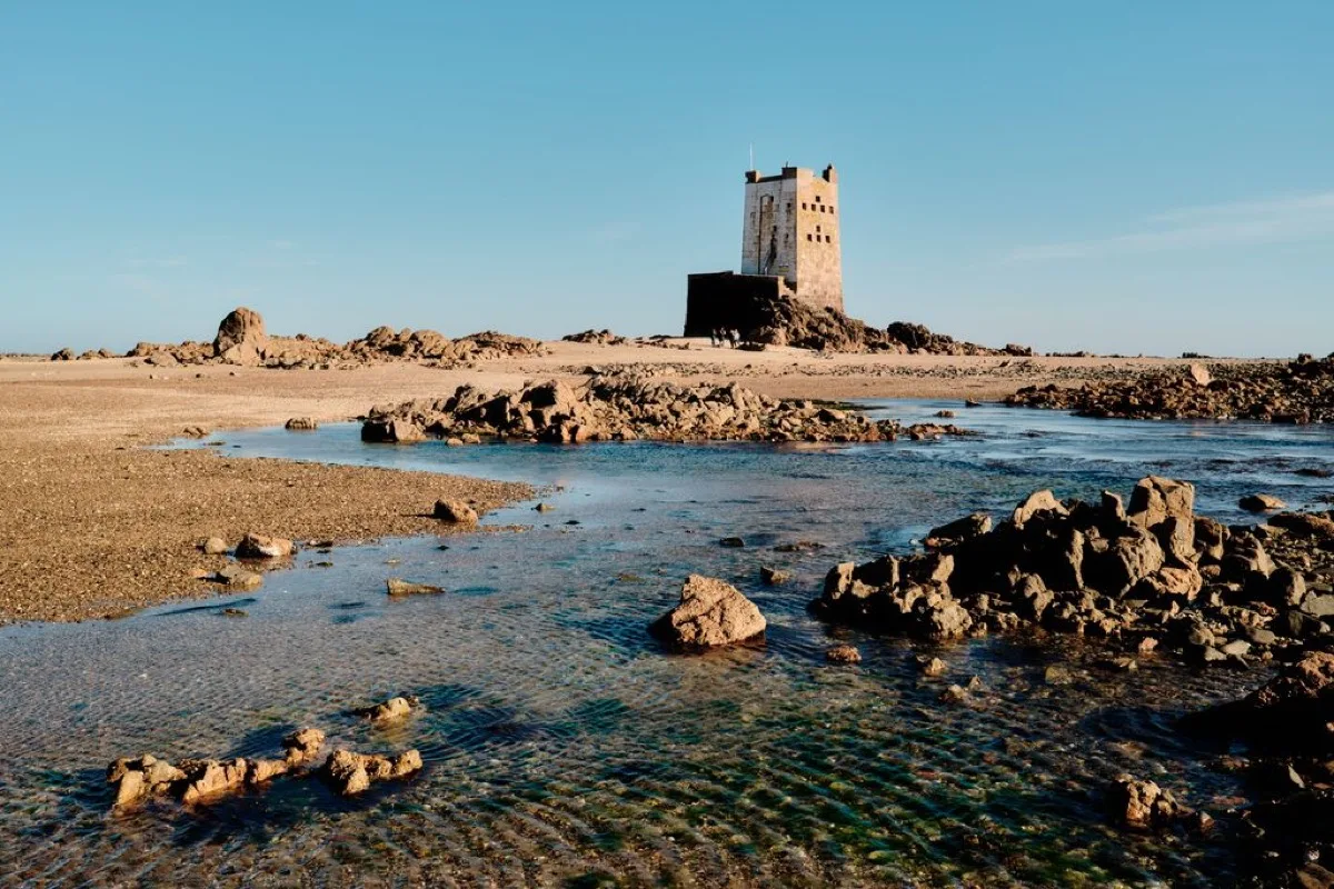
The low-water landscape south of Grouville forms part of Jersey's internationally important south-east intertidal area. Guided walks visit oyster beds, reefs, historic fishing structures and offshore towers.
The size and speed of the tide make local knowledge important. Official tourism information promotes guided intertidal walks rather than unsupported exploration far offshore.
There are rocks, channels and pools at lower tide, particularly towards the southern end and around reef areas. However, the distances involved are much larger than at a compact cove. Families looking for straightforward pools close to shore may find Green Island or Grève de Lecq easier to understand.
The ordinary sandy beach is well suited to long walks while the tide is out. A coastal route also links Gorey and La Rocque through beach paths, sea walls and quiet lanes; Visit Jersey describes this section as approximately 5.1km and relatively level.
Only following the accessible shoreline is an ordinary beach walk. Walking far out across offshore sandbanks, or attempting routes to reefs or towers, is not.
There are numerous slipways and access points along the bay. The best choice depends on whether you want Gorey and nearby food, a quieter central section, watersports, parking close to the beach, or access towards La Rocque.
The slipways provide firm routes to the upper beach, but at low tide there can be a long walk over sand before reaching the sea. The natural beach is not fully wheelchair accessible, although some sea-wall sections and promenades provide level views without crossing the sand.
Facilities vary along the length of the bay, and not every facility is available from every access point. They include:
The Royal Bay of Grouville is not lifeguarded.
No community photos of Royal Bay of Grouville yet. Be the first to add one and help build a picture of the beach at every state of the tide.
Add your photoOther bays and beaches close to Royal Bay of Grouville.
 South-east
 East
East East
East North-east
Tides. Tide predictions are forecasts. Actual sea level is affected by atmospheric pressure, wind and waves. Always observe the sea and your surroundings.
Swimming. Sea swimming carries risks: currents, waves, rocks, submerged structures, boats and cold water. This page is for planning and does not confirm conditions are safe. Do not assume the beach is lifeguarded.
Facilities. Facilities and café opening hours change seasonally. Check directly before making a journey specifically to use them.
 Jersey