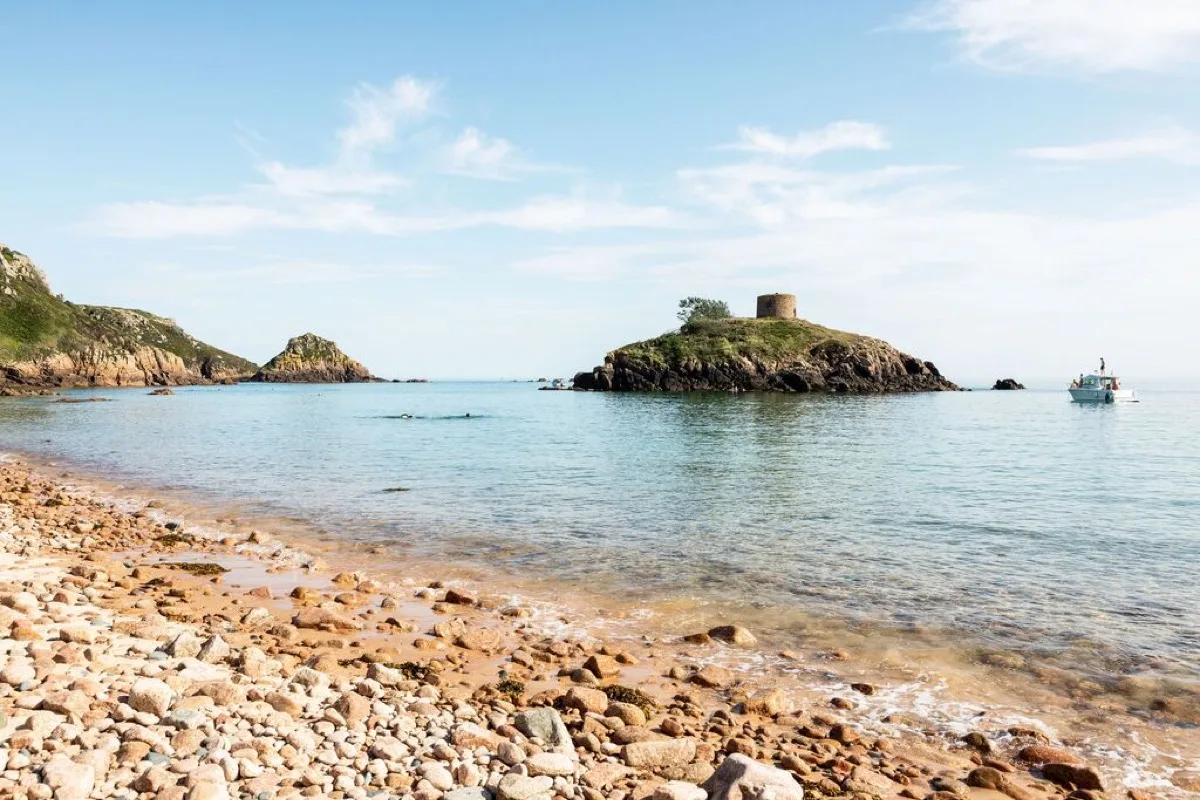
A south-facing sandy cove below steep cliff steps, with a tidal islet in the centre of the bay. Sand remains through much of the tide, while low water exposes a route to Île au Guerdain and additional rocks and pools.
These predictions use St Helier, Jersey’s standard reference port. Local timing and conditions at Portelet Bay can vary slightly with weather and coastal geography. Times are shown in local Jersey time.
The sandy route to Île au Guerdain is exposed at lower water and covered again as the tide rises. Return before water begins to cross the route, and do not wait for the island to appear fully cut off. Do not rely on being able to swim back.
Portelet is a south-facing sandy cove enclosed by cliffs between Noirmont and Portelet Common.
A rocky tidal islet, Île au Guerdain, stands near the centre of the bay. It carries a small tower associated with the burial place of Philippe Janvrin, a Jersey sea captain who died in 1721 after being prevented from landing during a period of quarantine.
The cove is reached by a long flight of steep steps from the cliff-top parking area. Its difficult access helps distinguish it from the more developed St Brelade's Bay, but it also makes the beach unsuitable for many visitors with reduced mobility.
At low water, the beach widens and a sandy route opens towards Île au Guerdain, with rocks and pools appearing around the island and edges of the bay.
As the tide rises, the route to the islet disappears and the sea divides around it. The upper beach generally retains more sand than steep north-coast coves such as Plémont, although space still reduces on larger tides.
Visit Jersey describes Portelet as suitable for swimming at any state of tide; more precisely, the bay usually retains accessible water throughout the tidal cycle, while entry points, depth and exposed rocks continue to change.
Portelet is a popular swimming cove. Its surrounding cliffs reduce exposure to prevailing westerly winds, but the bay remains connected to open water and can receive swell, chop and boat wash. At low tide, swimmers may need to walk farther across sand, but the water remains considerably closer than on Jersey’s broad, gently shelving bays.
At higher water, swimming access becomes shorter, Île au Guerdain is surrounded, submerged rocks are harder to see, the remaining beach becomes smaller and reflected movement can occur around the rocks. Do not treat the water around the islet as a protected pool, as tidal flow may be more noticeable through the channels either side. Portelet is not among the RNLI's 2026 patrolled Jersey beaches, so it is not lifeguarded.
Portelet is home to Jersey's first official snorkel trail, centred on the marine habitats around the bay and Île au Guerdain. The trail is not universally suitable: consider visibility, tide and flow around the island, cold water, submerged rocks, boat traffic, distance from shore and your ability to return without relying on the exposed sand route. Use it only in suitable sea conditions and within your swimming ability.
At lower water, exposed sand connects the islet to the main beach, and the route is covered again as the tide rises. People on the islet can swim back in suitable conditions, but that must not be a fallback plan; the safe approach is to return well before water begins to cross the route.
Low water reveals pools and rocky channels around the islet and at both sides of the bay. The most straightforward pools are those nearest the main beach; rocks around the islet involve a greater tidal commitment and can become isolated as the sea returns. Footwear is advisable because rock surfaces can be sharp and slippery.
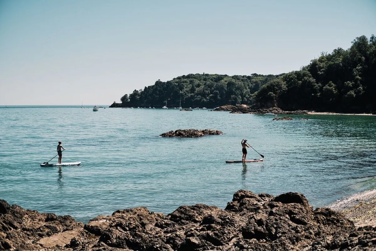
Portelet is visited by kayaks and small boats. The cliffs provide an enclosed setting, but boats must account for swimmers, snorkellers and submerged rocks. There is no road or slipway onto the beach, and carrying craft down the long staircase is impractical for most, so paddlers generally arrive by sea from another launch point.
Access is the defining practical limitation. Visitors descend a long series of steep cliff steps from the public parking area, and the return climb is strenuous, particularly in hot weather or while carrying beach equipment. The beach is not suitable for wheelchairs, people unable to manage prolonged stairs, heavily loaded pushchairs, or anyone who may struggle with the return ascent. The cliff-top viewpoint can be enjoyed without descending.
There are no road-level beach facilities, showers or lifeguard station. Facilities include:
Portelet Bay is not lifeguarded.
No community photos of Portelet Bay yet. Be the first to add one and help build a picture of the beach at every state of the tide.
Add your photoOther bays and beaches close to Portelet Bay.
 South
South South-west
 South-west
 South
SouthTides. Tide predictions are forecasts. Actual sea level is affected by atmospheric pressure, wind and waves. Always observe the sea and your surroundings.
Swimming. Sea swimming carries risks: currents, waves, rocks, submerged structures, boats and cold water. This page is for planning and does not confirm conditions are safe. Do not assume the beach is lifeguarded.
Facilities. Facilities and café opening hours change seasonally. Check directly before making a journey specifically to use them.
 Jersey